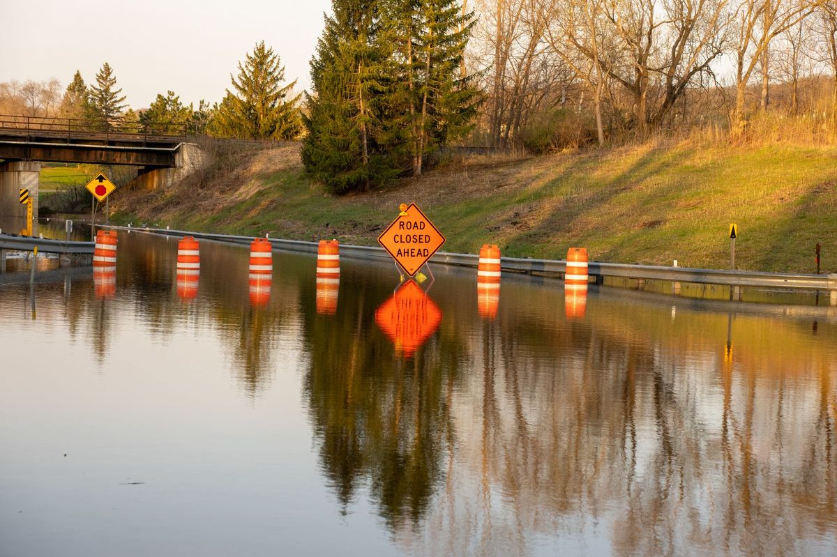
Federal and state spending on flood infrastructure construction has surged to $12.4 billion in active projects following a record year of flood-related disaster declarations and a growing consensus that aging levee systems, inadequate stormwater capacity, and climate-driven precipitation changes demand construction investment at unprecedented scale. The US Army Corps of Engineers, FEMA's Hazard Mitigation Grant Program, and state flood control agencies are collectively funding the largest wave of flood protection construction since the post-Katrina era.
The numbers tell a different story than the episodic disaster response framing that dominates media coverage. While individual flood events drive emergency spending and public attention, the current construction wave reflects a structural shift toward proactive flood infrastructure investment — building protection before disasters rather than rebuilding communities after them.
The $12.4 Billion Spending Breakdown
Flood infrastructure construction spending distributes across several categories and funding sources:
US Army Corps of Engineers Flood Risk Management: $5.8 billion active. USACE remains the dominant federal flood infrastructure agency, with construction authority over levees, floodwalls, dams, reservoirs, and coastal storm damage reduction projects. The IIJA provided $3.4 billion in supplemental flood construction funding on top of regular annual appropriations averaging $2.5 billion. Active Corps flood projects span 78 construction sites across 32 states, ranging from small urban flood wall segments to the $31 billion Coastal Texas Protection system.
FEMA Hazard Mitigation Grant Program (HMGP): $2.4 billion active. HMGP funds are made available after presidential disaster declarations, with states selecting and managing individual projects. Major HMGP flood construction categories include acquisition and demolition of repetitive-loss properties in flood-prone areas (managed demolition, environmental remediation, and site restoration), elevation of existing structures above updated base flood elevations using helical pile or concrete pier systems, and construction of localized flood protection systems for critical facilities and neighborhoods.
FEMA Building Resilient Infrastructure and Communities (BRIC): $1.6 billion active. BRIC provides competitive pre-disaster mitigation grants, with significant recent awards for large-scale stormwater infrastructure, green infrastructure flood management, and community flood barrier construction. Unlike HMGP, which is triggered by disasters, BRIC funds proactive construction before flooding occurs.
State and Local Programs: $2.6 billion active. States with the largest self-funded flood programs include Texas at $680 million through the Flood Infrastructure Fund established by constitutional amendment in 2019, Louisiana at $420 million through the Coastal Protection and Restoration Authority, New York at $380 million through the Environmental Bond Act, California at $340 million through Proposition 1 water bond funding, and North Carolina at $230 million through the state's Resilient Communities Program.
Major Active Construction Projects
The largest flood infrastructure projects under construction demonstrate the scale and engineering complexity of modern flood protection:
Coastal Texas Protection (Ike Dike): $3.2 billion Phase 1. The $31 billion Coastal Texas Study calls for a 70-mile coastal barrier system protecting the Houston-Galveston region from hurricane storm surge. Phase 1 construction includes the Bolivar Roads Gate System — a navigable storm surge barrier spanning the 2.3-mile entrance to Galveston Bay — and reinforcement and extension of the existing Galveston Seawall. The gate system will be the largest storm surge barrier in the Western Hemisphere, with sector gates each weighing over 5,000 tons.
Norfolk Coastal Storm Risk Management: $1.9 billion. Protecting Norfolk, Virginia — home to the world's largest naval base — from coastal storm surge and chronic tidal flooding. Construction includes 8.5 miles of floodwalls and storm surge barriers up to 12 feet high, 16 tide gate structures allowing normal drainage while blocking surge, and pump stations with combined capacity exceeding 2,000 cubic feet per second.
Fargo-Moorhead Diversion: $3.2 billion. A 30-mile diversion channel to protect the Fargo-Moorhead metro area from Red River flooding. The project, approximately 60% complete, involves excavating a channel 60 feet wide and 35 feet deep through agricultural land south and west of Fargo, with inlet and outlet control structures to regulate flow between the natural river channel and the diversion.
South Florida Everglades Restoration: $2.4 billion active. Multiple projects including the 10,500-acre EAA Reservoir designed to hold 240,000 acre-feet of water. The reservoir project requires moving approximately 120 million cubic yards of earth — one of the largest earthmoving operations currently underway in the United States. The reservoir will reduce harmful nutrient-laden discharges to coastal estuaries while providing flood storage capacity for southern Florida communities.
Construction Methods and Specialties
Flood infrastructure construction encompasses several specialized disciplines:
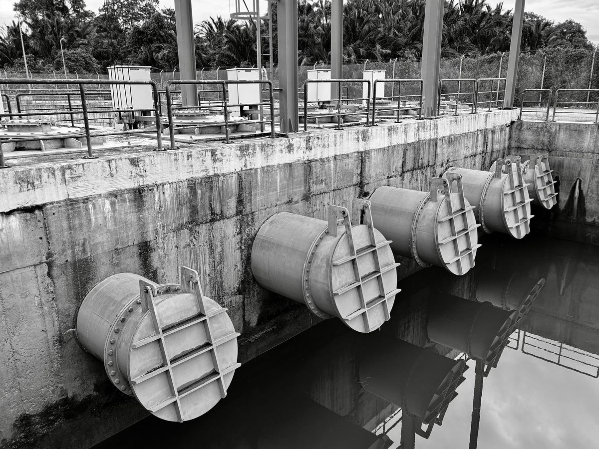
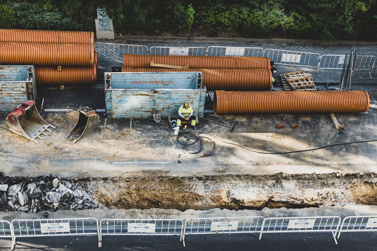
Levee Construction involves engineered earthwork on a massive scale. New levees require fill placement in controlled 6 to 12-inch lifts, compacted to 95% or greater of maximum dry density as verified by nuclear density gauge or other approved testing methods. Quality control is critical — a single deficient section can compromise miles of flood protection. Modern levees also incorporate seepage cutoff walls (soil-cement or cement-bentonite slurry walls extending through the levee foundation), armoring systems for overtopping protection using articulated concrete block or turf reinforcement mats, relief wells and toe drain systems to manage underseepage, and instrumentation including piezometers, settlement gauges, and inclinometers for long-term performance monitoring.
A typical mile of new levee requires 200,000 to 500,000 cubic yards of engineered fill, depending on levee height and foundation conditions. Equipment requirements include large earthmoving fleets of scrapers, articulated trucks, dozers, and pad-foot and smooth-drum compactors, along with GPS-guided grading systems for precise profile control.
Floodwall Construction uses reinforced concrete or steel sheet pile walls in urban areas where space constraints preclude earthen levees. Reinforced concrete floodwalls require deep foundations — typically drilled shafts 4 to 8 feet in diameter extending 40 to 80 feet deep — to resist hydrostatic pressure, hydrodynamic forces, and wave loads during design flood events. Wall heights range from 4 to 20 feet above grade, with wall thickness of 18 to 36 inches of reinforced concrete. Sheet pile floodwalls use interlocking steel sections driven to refusal or design embedment depth, with reinforced concrete caps and interior drainage systems.
Storm Surge Barriers represent the pinnacle of flood infrastructure engineering. Navigable storm surge barriers — like the Bolivar Roads system — require construction of massive concrete sill structures on the seabed, fabrication and installation of sector gates or vertical lift gates weighing thousands of tons each, construction of gate operating mechanisms including hydraulic systems and backup power, and coordination with navigation interests to maintain vessel traffic during construction. Only a handful of global contractors have experience with barrier construction of this scale, and US projects typically involve joint ventures combining American heavy civil contractors with European firms (particularly Dutch and British companies) that have built comparable barriers.
Pump Station Construction provides the mechanical capacity to manage interior drainage when flood barriers are closed. Modern flood pump stations require combined capacities of 1,000 to 5,000 cubic feet per second — equivalent to pumping an Olympic swimming pool every 5 to 25 seconds. Construction involves deep excavation (often 30 to 50 feet below grade), mass concrete foundations and wet well structures, installation of large-format pumps (typically mixed-flow or axial-flow designs with impeller diameters of 48 to 96 inches), electrical switchgear and motor control centers, dedicated utility substations for primary power, and diesel backup generators for operation during power outages.
Green Infrastructure is an increasingly significant component of flood spending, accounting for approximately $1.5 billion of the active pipeline. Green infrastructure includes constructed wetlands for flood storage, bioretention systems and rain gardens, living shorelines for coastal erosion protection, floodplain restoration reconnecting rivers to natural overflow areas, and urban permeable pavement and tree canopy programs.
Workforce and Equipment
Active flood infrastructure construction employs an estimated 45,000 workers nationally. Key trades include heavy equipment operators at 12,000 positions, laborers for embankment and concrete work at 10,000, pile drivers for floodwall foundations at 3,000, concrete workers at 6,000, and mechanical and electrical trades for pump stations at 4,000.
Equipment demands are heavy. A single large levee project can require 20 to 40 haul trucks, 8 to 15 excavators, GPS-guided dozers and motor graders, compaction rollers, and specialized equipment including slurry wall machines, vibratory pile hammers, and high-capacity dewatering systems.
Funding Outlook
The flood construction pipeline extends well beyond current projects. The USACE has $48 billion in authorized but unfunded flood projects, representing decades of potential work. The Bipartisan Infrastructure Law provided initial acceleration, but sustained annual appropriations of $3 to $4 billion will be needed.
Climate projections indicating increased precipitation intensity and sea level rise are driving state and local investment independent of federal funding. Texas's Flood Infrastructure Fund has committed over $1 billion, and similar state programs are expanding in Louisiana, New York, California, and North Carolina.
For construction firms, flood infrastructure is one of the most durable segments of the market. Unlike transportation projects that can be deferred in downturns, flood protection is driven by disaster experience, insurance market dynamics, and regulatory mandates that maintain urgency regardless of economic cycles. The $12.4 billion active pipeline will likely grow as new disasters trigger additional HMGP funding and states expand their own programs to address mounting fiscal exposure to flood damage.
Climate Adaptation: Designing for Future Conditions
A significant shift in flood infrastructure design is the adoption of future-conditions hydrology — designing structures not for historical rainfall patterns but for projected future conditions under climate change scenarios. The Army Corps of Engineers updated its engineering guidance in 2024 to require consideration of climate-informed hydrology in all new flood risk management projects.
This design shift has direct construction cost implications. Designing for projected increases in rainfall intensity of 10 to 40% by mid-century requires larger channels, higher levees, more powerful pump stations, and greater storage volumes compared to designs based on historical data. Engineers estimate that climate-informed design adds 15 to 30% to construction costs compared to historical-data designs — but the alternative is building infrastructure that is undersized on the day it opens.
Several major active projects incorporate future-conditions design. The Norfolk Coastal Storm Risk Management project is designed for 3 feet of projected sea level rise by 2080, requiring floodwall heights 3 feet taller than historical storm surge data alone would dictate. The Coastal Texas Protection system incorporates 2 feet of sea level rise and increased hurricane intensity projections. And the South Florida Everglades restoration projects account for projected changes in rainfall patterns and sea level affecting Everglades hydrology.
Insurance Market Dynamics
The insurance market is becoming a significant driver of flood infrastructure construction investment. FEMA's Risk Rating 2.0 methodology for the National Flood Insurance Program (NFIP) has resulted in substantial premium increases for many properties — in some cases 4x to 10x previous rates — creating political pressure for flood infrastructure investments that can lower flood risk and reduce insurance costs.
Private flood insurance markets are also growing and demanding better data on community flood protection infrastructure. Communities with higher levels of flood protection — maintained levees, pump stations, and stormwater systems — qualify for lower insurance rates under FEMA's Community Rating System (CRS), which can reduce NFIP premiums by 5 to 45% for participating communities.
The Compound Flooding Challenge
Coastal cities face a construction challenge that doesn't exist for inland communities: compound flooding, where multiple flood sources interact simultaneously. A coastal city can experience riverine flooding from upstream rainfall, coastal storm surge from hurricane or nor'easter events, tidal flooding from king tides or sea level rise, and stormwater flooding from local rainfall overwhelming drainage systems — all at the same time.
Designing and constructing infrastructure to manage compound flooding requires integrated systems that address multiple flood sources simultaneously, rather than the traditional approach of designing separate systems for each flood type. The Norfolk Coastal Storm Risk Management project illustrates this approach: the $1.9 billion system combines coastal storm surge barriers (addressing ocean-sourced flooding), interior drainage pump stations (managing rainfall while barriers are closed), tide gates (controlling tidal flooding), and stormwater system upgrades (handling local rainfall).
Integrated compound flood infrastructure costs 30 to 50% more than addressing individual flood sources separately, but provides dramatically better protection because it accounts for the interaction between flood sources that has historically caused the worst damage in coastal communities.
Nature-Based Solutions: Construction Growing Rapidly
Nature-based flood solutions — also called green infrastructure or natural infrastructure — represent the fastest-growing category of flood construction, with approximately $1.5 billion in active projects. Key project types include living shoreline construction using oyster reefs, marsh grass, and natural materials to absorb wave energy and reduce erosion along coastal waterways ($500 to $2,000 per linear foot), floodplain restoration projects that remove development from flood-prone areas and reconnect rivers to their natural overflow zones, constructed wetlands that provide flood storage while also treating stormwater runoff and providing habitat, and mangrove and coastal vegetation restoration that provides natural storm surge attenuation.
Nature-based solutions require different contractor capabilities than traditional gray infrastructure — ecological knowledge, experience with native plant materials, understanding of tidal and hydrological systems, and ability to work in sensitive aquatic environments. Contractors who develop these capabilities will be well-positioned in a growing market segment that is increasingly favored by federal funding programs (both FEMA and the Army Corps have explicit preferences for incorporating nature-based solutions in flood risk management projects).
Frequently Asked Questions
How much federal funding goes to flood infrastructure construction spending?
According to the latest industry data, flood infrastructure construction spending is showing notable trends in 2026. Current figures indicate $12.4 billion, which represents a significant benchmark for contractors and developers planning projects this year. Regional variations apply, so checking local market conditions remains essential for accurate budgeting.
Which states benefit most from flood infrastructure construction spending?
Regional analysis of flood infrastructure construction spending reveals uneven distribution across U.S. markets. The data point of $12.4 Billion highlights the scale of activity, with Sun Belt and high-growth metro areas generally leading in volume. Contractors expanding into new territories should evaluate local demand indicators before committing resources.
What is the timeline for flood infrastructure construction spending projects?
The trajectory for flood infrastructure construction spending tells an important story when viewed against historical benchmarks. With the latest data showing $5.8 billion, the trend has clear implications for project feasibility, bidding accuracy, and resource allocation across the construction sector.